MIRICO CLOUD Enables Real-time, Visual Monitoring of Methane Emissions
MIRICO released MIRICO CLOUD to the oil & gas industry, an online platform that enables real-time visualisation of methane emissions data collected from their high precision gas sensing instruments.
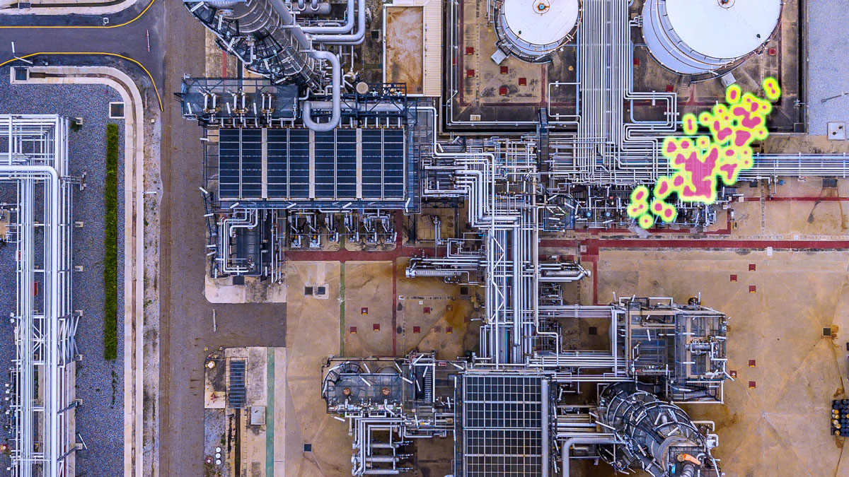
MIRICO CLOUD takes this data and lets customers visualise the detection, localisation, and quantification of methane emissions across multiple oil & gas sites, all in one place. By producing results in real-time, customers can act quickly to fix issues causing changes in emissions. Enabling them to decrease or even stop downtime and reduce the risk of fines from environmental authorities.
To help customers react as quickly as possible, MIRICO CLOUD also offers the facility to receive notifications based on custom parameters, either via SMS or email. For example, to be alerted of a new emission that is above a certain size, or about an existing known emission that has started to grow.
The easy-to-use interface allows customers to see the layout of each of their sites, and overlay this with information such as path averages, location of detected emissions and quantification of any leaks. This information can all be viewed in real-time with the ability to see historical data and track changes over time.
Through the customisable dashboard customers can also view high level, key information. For example, they can see average emissions over the last 24 hours or see how emissions vary by asset type.
“It’s great to be able to broaden the service we provide our customers,” said Dr Linda Bell, CEO of MIRICO. “We really feel this is a big step forward in helping the oil & gas industry to quickly identify emission issues at scale and ultimately help them in their goals to reach net zero”.
About MIRICO
MIRICO was founded in 2015 as a spin out from the Laser Spectroscopy Group at the STFC Rutherford Appleton Laboratory. MIRICO’s instruments revolutionise gas sensing by offering the unique combination of real time analysis with high sensitivity, accuracy and stability, a wide dynamic range, and the ability to perform remote sensing across a range of challenging conditions.


